GeoEye One

Five years ago today — September 6, 2008 — a Delta II rocket launched from Vandenberg AFB carrying a privately-owned remote sensing satellite.


(GeoEye 1. Image from the Satellite Imaging Corporation web page.)

Despite being privately owned and operated, one of GeoEye 1‘s main customers for its multi-spectral images is the Department of Defense. You can see a selection of GeoEye imagery in this gallery.

And on the same day that GeoEye 1 launched, the Chinese launched two environmental monitoring satellites, Huan Jing 1A and Huan Jing 1B, from the Taiyuan launch site on a Long March 2C rocket.

So, 5 years ago today was a good day for remote sensing!

Facebooktwitterpinterestlinkedinmailby feather

On My Way Out the Door: First Afghani Cosmonaut, and Five German Satellites

I’m headed to Dragon Con in just a little while! But first …

Twenty-five years ago today — August 29, 1988 — a Soyuz rocket out of the Baikonur Cosmodrome carried the first Afghani citizen to fly in space.


(Soyuz TM-6 insignia from Wikimedia Commons.)

The Soyuz TM-6 crew consisted of Russian cosmonauts Vladimir A. Lyakhov and Valeriy V. Polyakov, plus Afghani cosmonaut Abdul Ahad Mohmand. They spent a little over a week on the Mir space station before returning to earth.

In other space history, on this date 5 years ago another mission from the Baikonur Cosmodrome carried five German remote sensing satellites known as RapidEye-A through -E.

And speaking of remote sensing, congratulations to the Delta 4 launch team for successfully launching a National Reconnaissance Office satellite yesterday from my old stomping grounds, Vandenberg AFB!

Facebooktwitterpinterestlinkedinmailby feather

Radio Astronomy Explorer One

Fortyfive years ago today — July 4, 1968 — a Thor Delta rocket launched from Vandenberg AFB carrying the latest in NASA’s Explorer series of spacecraft.


(A technician checks Explorer 38. NASA image.)

Radio Astronomy Explorer 1, also known as Explorer 38, was designed to observe celestial radio sources — natural sources like the sun — and record the intensity of their signals over time. Despite several malfunctions, including degradation of its tape recorder, the spacecraft produced good data for scientists to examine.

Facebooktwitterpinterestlinkedinmailby feather

First Ocean-Watching Radar Satellite

Thirty-five years ago today — June 27, 1978 — an Atlas-Agena launch vehicle out of Vandenberg AFB carried the SeaSat-1 observation satellite to orbit.


(SeaSat 1. NASA image.)

SeaSat 1, also known as the Ocean Dynamics Satellite, was “designed to provide measurements of sea-surface winds, sea-surface temperatures, wave heights, internal waves, atmospheric liquid water content, sea ice features, ocean features, ocean topography, and the marine geoid.”

SeaSat 1 was the first synthetic aperture radar satellite designed to monitor the oceans from space, but unfortunately a “massive short circuit in its electrical system” in October 1978 cut the mission short. Nevertheless, SeaSat 1 “returned a unique and extensive set of observations of the earth’s oceans” and, according to this mission page, also demonstrated “the feasibility of global satellite monitoring of oceanographic phenomena and [helped] determine the requirements for an operational ocean remote sensing satellite system.”

Facebooktwitterpinterestlinkedinmailby feather

First Titan 34D Launch from Vandenberg

Thirty years ago today — June 20, 1983 — a pair of satellites were launched from Vandenberg AFB atop a Titan 34D booster.


(Titan 34D launching from Cape Canaveral. DoD image from Wikimedia Commons.)

Launched from Space Launch Complex (SLC, pronounced “slick”) 4-East, the two DoD satellites were designated 1983-060A (or 14137) and 1983-060C (or 14139), but a 2011 Space Review article identified the primary payload of this particular launch as a KH-9 reconnaissance satellite. The Titan 34D Wikipedia page notes the June 1983 launch as the first Vandenberg launch for the 34D configuration.

As an old Titan System Program Office guy, I’d just as soon end there, but as an old Vandenberg guy I’ll toss in another space anniversary: On this date 5 years ago, the French and U.S. Jason 2 satellite was launched from Vandenberg on a Delta II rocket. Jason 2 was designed to monitor oceanic conditions from space, and was “a cooperative mission involving the French CNES, the European EUMETSAT, and the American NOAA and NASA.”

Facebooktwitterpinterestlinkedinmailby feather

EXOSAT

Thirty years ago today — May 26, 1983 — the European X-ray Observatory Satellite was launched from Vandenberg AFB on a Delta rocket.


(EXOSAT. NASA image.)

EXOSAT was built to study cosmic X-ray sources from a highly eccentric orbit. The satellite operated until April 1986 and “made 1780 observations of a wide variety of objects, including active galactic nuclei, stellar coronae, cataclysmic variables, white dwarfs, X-ray binaries, clusters of galaxies, and supernova remnants,” according to this European Space Agency page.

Facebooktwitterpinterestlinkedinmailby feather

The Loss of Nimbus-B … and Recovery of Its Radioactive Power Source

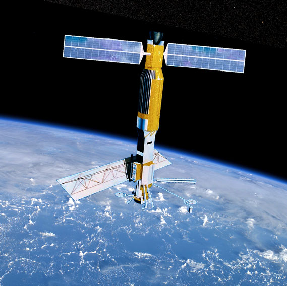
Forty-five years ago today — May 18, 1968 — a Thor-Agena rocket launched from Vandenberg AFB, carrying the Nimbus-B satellite. Unfortunately, a problem with the launch vehicle’s guidance system caused the rocket to veer off-course, and it had to be destroyed by Range Safety.


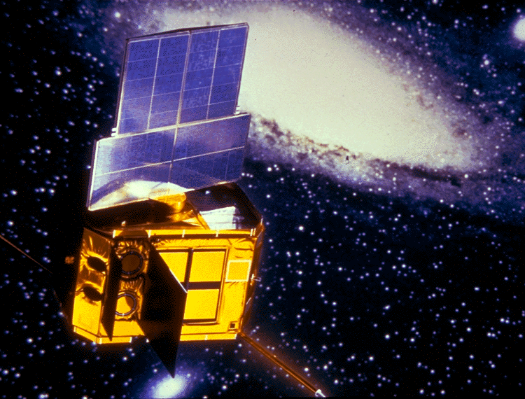
(The Nimbus B RTG fuel containers on the seafloor. NASA image.)

Nimbus-B was a research-and-development weather satellite, with a number of instruments and experimental packages:

(1) a satellite infrared spectrometer (SIRS) for determining the [vertical] temperature profiles of the atmosphere,
(2) an infrared interferometer spectrometer (IRIS) for measuring the emission spectra of the earth-atmosphere system,
(3) both high- and medium-resolution infrared radiometers (HRIR and MRIR) for yielding information on the distribution and intensity of infrared radiation emitted and reflected by the earth and its atmosphere,
(4) a monitor of ultraviolet solar energy (MUSE) for detecting solar UV radiation,
(5) an image dissector camera system (IDCS) for providing daytime cloudcover pictures in both real-time mode, using the real-time transmission system (RTTS), and tape recorder mode, using the high data rate storage system (DHRSS),
(6) a radioisotope thermoelectric generator (RTG), SNAP-19, to assess the operational capability of radioisotope power for space applications, and
(7) an interrogation, recording, and location system (IRLS) designed to locate, interrogate, record, and retransmit meteorological data from remote collection stations.

When the spacecraft ended up the ocean, that item number 6 became a prime concern. But according to this page on radioisotope power systems, everything functioned as designed and the SNAP-19 generator’s plutonium fuel remained intact and protected. In fact, the plutonium was recovered from the ocean floor and eventually used to power the Nimbus-III satellite.

Finally, on a personal note, this reminds me of the loss of another rocket, 20 years ago this fall, for which I ran the maritime search-and-salvage operation. But that will be the subject of another post when its anniversary date rolls around.

Facebooktwitterpinterestlinkedinmailby feather

Pegasus Carries Solar Explorer

Fifteen years ago today — April 1, 1998* — a Pegasus XL originating from Vandenberg AFB carried a small satellite to study the Sun’s atmosphere.


(Coronal “loops” above the Sun’s surface, in a false-color image from TRACE. NASA image.)

The Transition Region And Coronal Explorer, or TRACE, carried a single multi-spectral instrument to

examine the three-dimensional magnetic structures which emerge through the Sun’s photosphere (the visible surface of the Sun) and define both the geometry and dynamics of the upper solar atmosphere (the transition region and corona).

In more detail, TRACE was built to achieve three primary objectives:

  1. follow the evolution of magnetic field structures from the solar interior to the corona;
  2. investigate the mechanisms of the heating of the outer solar atmosphere; and,
  3. determine the triggers and onset of solar flares and mass ejections.

The effectiveness of TRACE’s telescopic sensor was due to its sophisticated attitude control system, which combined magnetic-torquers, reaction wheels, and inertial gyros to maintain its pointing accuracy within 5 arc-seconds.

The TRACE mission lasted until June 2010, and produced some stunning images of our Sun.

___

*April 2nd UTC.

Facebooktwitterpinterestlinkedinmailby feather

Last Saturn-Apollo Block 1 Suborbital Test Flight

Fifty years ago today — March 28, 1963 — the Saturn-Apollo 4 mission was launched from Cape Canaveral.


(Saturn SA-4. NASA image.)

Saturn-Apollo (SA) 4, or Apollo SA-4, was the final “Block 1” Saturn test, the last of four test launches of the Saturn rocket’s first stage.

The rocket was launched on a sub-orbital flight to an altitude of 129 km and a peak velocity of 5906 km/hr. After 100 seconds of flight, a pre-set timer cut off engine no. 5 as planned to test the “engine-out” capability of the booster. Fuel was successfully routed to the other seven engines and the flight continued.

Also on this date in space history, 30 years ago, the first of an advanced series of remote-sensing spacecraft, NOAA 8, launched into a polar orbit atop an Atlas E rocket out of Vandenberg AFB. Unfortunately, the satellite did not live out its two-year planned operational life: it failed in June 1984.

Finally, 10 years ago today — March 28, 2003 — Japan launched a pair of reconnaissance satellites, IGS (Information Gathering Satellite) 1A and IGS 1B, from Tanegashima Space Center on an H-2A rocket. According to the National Space Science Data Center, “One of the two spacecraft uses optical cameras with a resolution of one meter; the other uses synthetic aperture radar to provide images at a resolution of a few meters,” but it is unclear which satellite carried which sensor.

Facebooktwitterpinterestlinkedinmailby feather

The Evolution of Launch Capability: 3 Decades, 3 Launches

Today’s space history entry provides a glimpse of how space launch operations improved in the first 20 years of the space age.

First, 55 years ago today — March 5, 1958 — we attempted to launch the Explorer 2 satellite from Cape Canaveral on a Jupiter C rocket. The vehicle lifted off without incident (which some in the industry might consider a launch success), but its upper stage failed and the satellite did not reach orbit.


(Explorer 2 launch. US Army image from Wikimedia Commons.)

Ten years later, on March 5, 1968, the small scientific satellite SOLRAD 9 launched aboard a Scout vehicle from the Wallops Flight Facility in Virginia. SOLRAD 9 was also known as Explorer 37, and it operated successfully until 1974.

And then 10 years later still — on this date in 1978 — Landsat 3 launched atop a Delta rocket out of Vandenberg AFB, with the Oscar 8 amateur radio satellite along for the ride.

So, on this date in space history we had three launch attempts, each a decade removed from another, from three different launch bases, resulting chronologically in a failed mission, a successful mission, and a successful multi-satellite mission. That seems like progress.

Facebooktwitterpinterestlinkedinmailby feather