Flying Atlantis to Orbiting Peace

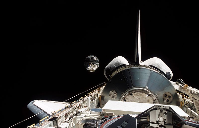
Fifteen years ago today — January 12, 1997 — the Space Shuttle Atlantis launched from the Kennedy Space Center to dock with the Mir (“peace”) space station.


(Shuttle Atlantis rolling out to the pad from the VAB [December 1996]. NASA image.)

Mission STS-81 astronauts Michael A. Baker, Brent W. Jett, Jr., John M. Grunsfeld, Marsha S. Ivins, Peter J. K. Wisoff, and Jerry M. Linenger docked with the Russian station; Linenger stayed behind, while Atlantis brought home astronaut John Blaha after his 4-month stay.

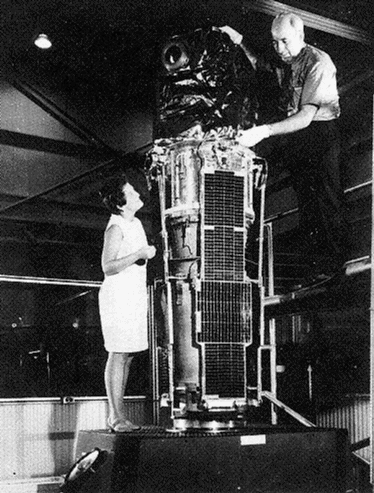
On a belated space history note, 45 years ago yesterday — January 11, 1967 — the Intelsat II F-2 communications satellite launched from Cape Canaveral on a Delta rocket. It was positioned over the Pacific as the first fully-operational Intelsat II platform.

F-2 was the first Intelsat II satellite over the Pacific because its predecessor, F-1, did not reach its intended orbit. F-1’s “apogee engine thrust terminated approximately 4 seconds after ignition,” stranding the spacecraft in the wrong orbit.

Interestingly, an apogee engine malfunction nearly caused the loss of the USAF’s Advanced Extreme High Frequency (AEHF) satellite after its launch in July 2010. AEHF operators and engineers figured out an innovative orbit-raising sequence that rescued the spacecraft and put it in the proper operating position last October. Well done!

Facebooktwitterpinterestlinkedinmailby feather

Another STARSHINE, and a Descendant of BioSat

A pair of small satellites launched on this date in space history …


(STARSHINE-2, released from the shuttle payload bay. NASA image, from Wikimedia Commons.)

First, 10 years ago today — December 16, 2001 — the crew of STS-108 released STARSHINE-2 while preparing for their return to Earth. Like its predecessors — STARSHINE-1 and STARSHINE-3 — this “microsatellite” was built with the help of students from around the world: students in 26 countries helped to polish the over 800 mirrors that studded the spacecraft’s surface, making the satellite highly reflective so they could track it in its orbit. The STARSHINE acronym stands for “Student Tracked Atmospheric Research Satellite Heuristic International Networking Experiment,” and more than 25,000 students participated in the project.

Five years later, on this date in 2006, a Minotaur rocket launched from Wallops Island, Virginia, carrying the “nanosatellite” GeneSat-1. Conceptually similar to BioSatellite-1, GeneSat-1 carried samples of bacteria — specifically, E. Coli — to monitor the effects of space radiation. Unlike the BioSatellite series, which involved returning the samples to earth for study, GeneSat-1 carried special optical instruments to observe the bacteria and radioed those observations to the ground.

Facebooktwitterpinterestlinkedinmailby feather

Happy Thanksgiving! Oh, and Some Space History

Wishing you and yours a most Happy Thanksgiving!

Walking the dog this morning, I thought about things for which I’m thankful — the list is long, and I’m sure I didn’t think of everything. More things are coming to mind even as I type this.

I think it’s good for us to pause, reflect, and express appreciation for what we have — especially family and friends — rather than being bitter and resentful over things we don’t have. The Apostle Paul wrote that he had learned how to be content in every situation;* I’m not quite there yet, but I hope to be.

So, may we all find things for which we can be truly thankful, today and every day.

[BREAK, BREAK]

Now, the promised “Space History”…

Twenty years ago today — November 24, 1991 — the Space Shuttle Atlantis lifted off from the Kennedy Space Center on a Department of Defense mission.


(DSP satellite being tilted to its predeployment position in the shuttle’s payload bay. NASA image.)

During mission STS-44, astronauts Frederick D. Gregory, Terence T. “Tom” Henricks, James S. Voss, Story F. Musgrave, Thomas J. Hennan, and Mario Runco deployed the third Defense Support Program (DSP) missile warning satellite.

Without going into too much detail, DSP satellites stare at the earth, looking for the infrared signatures of rocket exhaust that would indicate ballistic missile launches.

Which, if nothing else, perhaps we can all be thankful for eyes in the sky that are watching out for sneak attacks.

___
*Philippians chapter 4.

Facebooktwitterpinterestlinkedinmailby feather

PAGEOS: Triangulation Target in Space

Forty-five years ago today — June 23, 1966 — the Passive Geodetic Earth Orbiting Satellite was launched by a Thor-Agena rocket from Vandenberg Air Force Base, California.


(Test inflation of PAGEOS. Note the relative sizes of the trucks and people in the lower right. The test took place in a blimp hangar in Weeksville, North Carolina. NASA image from Wikimedia Commons.)

The PAGEOS was an inflatable sphere exactly 100 feet (30.48 meters) in diameter, made of aluminized mylar. Being highly reflective, it was used as a tracking target by ground stations; triangulating on the spacecraft, since its orbit was known to a high degree of accuracy, allowed the ground stations to improve the accuracy of world survey maps.

Facebooktwitterpinterestlinkedinmailby feather

A Space Platform for Laser Ranging

Thirty-five years ago today — May 4, 1976 — the LAGEOS-1 satellite launched on a Delta rocket from Vandenberg AFB.


(LAGEOS. NASA image.)

The Laser Geodynamics Satellite (LAGEOS) (also known as the Laser Geodetic Satellite) “was the first spacecraft dedicated exclusively to high-precision laser ranging and provided the first opportunity to acquire laser-ranging data that were not degraded by errors originating in the target satellite.”

The spacecraft itself was simple: a sphere covered with 426 “cube corner reflectors” or retroreflectors which return light directly to its source no matter the incident angle. According to this page, LAGEOS-1 also carried a small plaque designed by Carl Sagan:

The plaque is 4 inches by 7 inches (10 cm by 18 cm) stainless steel plate. The spacecraft carries two identical copies included in its interior. In its upper center it displays the simplest counting scheme, binary arithmetic. The numbers one to ten in binary notation are shown. At upper right is a schematic drawing of the Earth in orbit around the Sun, and an arrow indicating direction of motion. The arrowhead points to the right, the convention adopted for indicating the future. All arrows accompanying numbers are “arrows of time”. Under the Earth’s orbit is the binary number one, denoting the period of time used on the plaque — one revolution of the Earth, or one year. The remainder of the LAGEOS plaque consists of three maps of the Earth’s surface. The first map denotes the Earth 268 million years in the past. All the continents are shown together in one mass. The close fit of South America into West Africa was one of the first hints that continental drift actually occurs. The middle map represents the zero point in time for the other two maps. It displays the present configuration of the planets. The final map shows the Earth’s surface 8.4 million years from now — very roughly the estimated lifetime of the LAGEOS. Many important changes in the Earth’s surface are shown, including the drift of California out into the Pacific Ocean. Whoever comes upon the LAGEOS plaque needs only compare a current map of the Earth’s geography with that in the lower two maps to calculate roughly the difference between his time and ours.

Put it on your calendar: let’s meet up with LAGEOS-1 8 million years from now and see how accurate Sagan’s continental drift picture is.

Facebooktwitterpinterestlinkedinmailby feather

Hermes, Messenger of the Gods … in Space

Thirty-five years ago today — January 17, 1976 — a Delta launch vehicle out of Cape Canaveral launched the Communications Technology Satellite into geosynchronous orbit.


(Artist’s conception of the Hermes satellite. Canadian Space Agency image.)

Also called Hermes, after the messenger god of Greek mythology, CTS was an international mission to test new global communications techniques and equipment. According to this informative Online Journal of Space Communication article:

Under the agreement with NASA, Canada designed and built the spacecraft. NASA provided an experimental 200W traveling-wave-tube amplifier (TWTA) and environmental test support. In 1972, DOC/CRC [Canada’s Communications Research Centre] signed an agreement with the European Space Agency (ESA), under which ESA agreed to provide 20W TWTAs, a SHF parametric amplifier and to develop the solar blanket.

NASA provided the launch vehicle, launch and operational support to place the spacecraft in the geostationary satellite orbit. Following the handover from NASA to DOC/CRC of the satellite in orbit at 116 [degrees] W longitude, DOC/CRC configured the satellite for its operational mission, and operated the satellite for U.S. and Canadian communications and spacecraft technology experiments.

The Hermes operations proved very successful, and led to much-improved geosynchronous satellite communications that we all enjoy today.

Facebooktwitterpinterestlinkedinmailby feather

The Beginning of Space-Based X-Ray Astronomy

Forty years ago today — December 12, 1970 — NASA launched Explorer-42, the first of a series of small observatories, from the San Marco launch platform off the coast of Kenya.


(The Uhuru satellite in pre-flight checkout, with Dr. Marjorie Townsend [who named the spacecraft] and Dr. Bruno Rossi. NASA image.)

Also called Uhuru, the spacecraft was built to scan the celestial sphere for X-ray sources. In fact, the catalog of sources developed from its data is still in use. Other spacecraft in the series were built to survey the sky in other energy regimes, e.g., in the gamma-ray and ultraviolet parts of the spectrum.

According to this page of Goddard Space Flight Center “Facts and Firsts,” Uhuru “catalogued more than 200 X-ray sources and found the first evidence for a black hole” at Cygnus X-1.

This NASA “Imagine the Universe!” page points out that Uhuru means “freedom” in Swahili, and the spacecraft was so named in honor of its Kenyan hosts. It was also launched on the seventh anniversary of Kenya’s independence.

Facebooktwitterpinterestlinkedinmailby feather

First Flight for Shuttle ATLANTIS, and the First Repeater Satellite

Twenty-five years ago today — October 4, 1985 — the Space Shuttle Atlantis was in orbit on its maiden flight.


(First launch of the Shuttle Atlantis, October 3, 1985. NASA image.)

Atlantis actually launched from the Kennedy Space Center 25 years ago yesterday on mission 51J. This first mission was a DoD mission, in which astronauts Karol J. Bobko, Ronald J. Grabe, Robert A. Stewart, David C. Hilmers and William A. Pailes deployed what was later revealed to be a pair of Defense Satellite Communication System (DSCS, pronounced “discus”) satellites.

[BREAK, BREAK]

Also on this date, but twice as long ago — October 4, 1960 — the world’s first repeater satellite, Courier-1B, was launched from Cape Canaveral on a Thor “Ablestar” rocket. The first Courier satellite had been lost due to a launch vehicle failure. For more on the Courier experimental communication satellite, see this article.

Facebooktwitterpinterestlinkedinmailby feather

Satellite Triple Play, Plus One

Twenty-five years ago today — August 27, 1985 — astronauts Joe H. Engle, Richard O. Covey, James D. Van Hoften, William F. Fisher and John M. Lounge lifted off from the Kennedy Space Center aboard Space Shuttle Discovery.


(Unidentified STS-51I astronaut in the Shuttle Discovery’s open cargo bay. NASA image.)

Mission STS-51I lasted a week, during which the crew deployed three communications satellites: American Satellite Company 1 (ASC-1), Australian Communications Satellite 1 (AUSSAT-1), and Synchronous Communications Satellite IV-4 (SYNCOM-IV-4), also known as LEASAT-4 because most of its communications capacity was to be leased out to the military.

The crew also retrieved SYNCOM-IV-3 (LEASAT-3), which had been launched the previous April by STS-5lD but had failed to activate. As described on this Boeing page,

After attaching special electronics assemblies to LEASAT 3 during two days of space walks, astronauts manually launched the satellite again. The electronics allowed ground controllers to turn on the satellite and, at the end of October, fire its perigee rocket and send LEASAT 3 into orbit.

While LEASAT-3’s repair was a success, LEASAT-4 developed its own problems. The satellite reached its intended orbit, but its ultra high frequency (UHF) downlink failed during testing and it was declared a total loss.

Facebooktwitterpinterestlinkedinmailby feather

First Successful CORONA Mission

Fifty years ago today — August 18, 1960 — Discoverer-14 launched from Vandenberg AFB. It was known to the public by that name, but to insiders in what would become the National Reconnaissance Office it was known as CORONA Mission 9009.


(Aerial recovery of Discoverer-14. USAF image from Wikimedia Commons.)

Discoverer-14 was the first CORONA mission in which the film canisters were successfully recovered from orbit.

The National Space Science Data Center describes the film recovery process:

Over Alaska on the 17th pass around the earth, the Agena ejected Discoverer 14 from its nose and retrorockets attached to the reentry vehicle fired to slow it for the return from orbit. After Discoverer 14 reentered the atmosphere, it released a parachute and floated earthward. The descending parachute was sighted 360 miles southeast of Honolulu, Hawaii, by the crew of a US Air Force C-119 recovery aircraft from the 6593rd Test Squardon based at Hickam AFB, Hawaii. On the C-119’s third pass over the parachute, the recovery gear trailing behind the aircraft successfully snagged the parachute canopy. A winch operator aboard the C-119 then reeled in the Discoverer after its 27-hour, 450,000 mile journey through space. This was the first successful recovery of film from an orbiting satellite and the first aerial recovery of an object returning from Earth orbit.

The NSSDC also notes that “38 Discoverer satellites were launched by February 1962,” although the CORONA project itself continued until 1972. CORONA was declassified in 1995.

Facebooktwitterpinterestlinkedinmailby feather