Twenty years ago today — August 10, 1992 — an Ariane 42P launch vehicle launched from Kourou, French Guiana, carrying the TOPEX/Poseidon satellite.
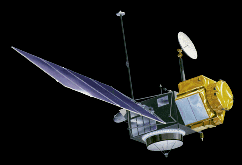
(TOPEX/Poseidon. NASA image.)
Officially the Ocean Topography Experiment, TOPEX/Poseidon was a joint mission between NASA and France’s Centre National d’Etudes Spatiales to measure sea-surface heights from a space-based radar platform. It was also the second spacecraft in the “Mission to Planet Earth” program.
The TOPEX/Poseidon spacecraft was decommissioned in January 2006, but the Jason-1 and Jason-2 follow-on spacecraft are continuing the mission. The Ocean Surface Topography page presents details on all of the missions associated with the space-based study of our world’s oceans.
So, next time you’re at the beach and thinking about how high the waves are, remember that satellites hundreds of miles above you are looking down, thinking about the same thing.